Website link:Lushan Global Geopark (lushangeopark.com)
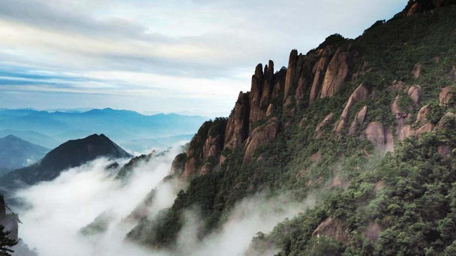
Lushan Global Geopark is located in the northern part of Jiangxi Province, bordering the Yangtze River to the north and Poyang Lake to the east. The park covers an area of 548 square kilometers and has a core scenic area with over 10000 people. The average elevation of the mountain top is 1200 meters. It was listed in the The World Heritage List in 1996, and is the first "world cultural landscape" in China. In 2004, he became one of the first members of the World Geopark Network.
Lushan Mountain is famous for its polygenetic composite geomorphic landscape composed of typical Quaternary glacial relics, horst type fault block mountain structure and metamorphic core complex structural relics in the eastern mountains of Chinese Mainland. Its topography is closely linked to plants, culture, and history. Here, the scenery is beautiful, the forests are dense, and there are flying streams, canyons, mountain peaks, waterfalls, and springs all available; Foreign villas with diverse styles abound; Different religions coexist harmoniously. The uninterrupted historical carrying and rich cultural heritage of both China and the West make it known as the "holy mountain of humanity".
Website link:Mount Huangshan Scenic Area Management Committee (huangshan.gov.cn)
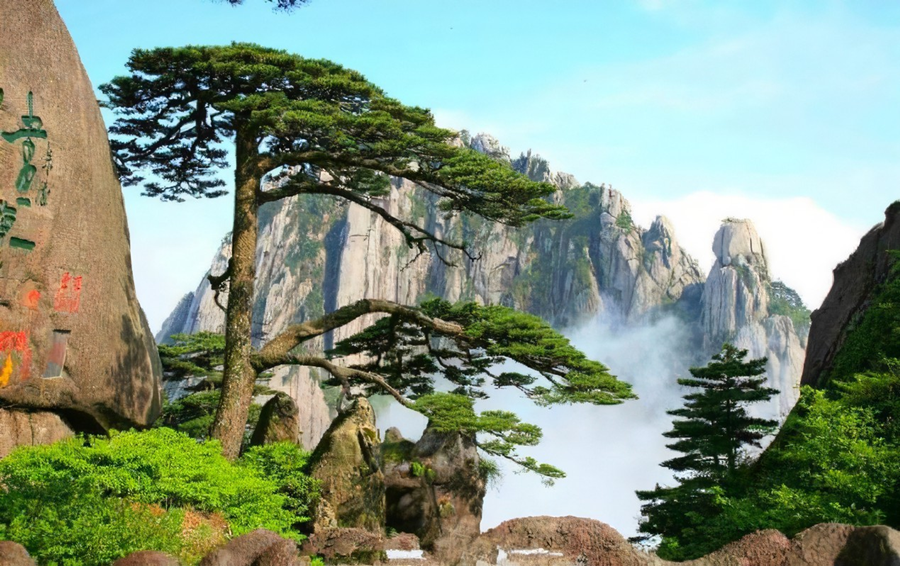
Mount Huangshan is located in Mount Huangshan City in the south of Anhui Province. The mountain is about 40 kilometers long from north to south, 30 kilometers wide from east to west, and has a total area of about 1200 square kilometers. Among them, Mount Huangshan Scenic Area covers an area of 160.6 square kilometers, spanning 118 ° 01 '-118 ° 17' east longitude and 30 ° 01 '-30 ° 18' north latitude. It starts from Huangshi in the east, ends at the foot of Xiaoling in the west, starts from Erlong Bridge in the north, and ends at Tangkou Town in the south. It is divided into nine management areas, namely, Hot Spring, Yungu, Yuping, Beihai, Songgu, Fishing Bridge, Fuxi, Yanghu, and Fugu.
Website link:Tianzhu Mountain UNESCO Global Geopark (tzsgy.com)
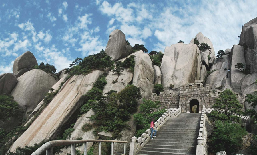
Tianzhu Mountain UNESCO Global Geopark is located in Qianshan City, Anhui Province, China. It borders the Dabie Mountains to the northwest and the Yangtze River to the southeast, covering an area of 413.14 square kilometers. The main peak has an elevation of 1489.8 meters and stands tall and independent like a towering pillar, hence the name "Tianzhu". The park is located in the eastern section of the Dabie orogenic belt between the North China and Yangtze plates and at the composite site of the Tan Lu fault zone. This is an important section of the world's largest, deepest exposed, best exposed, and richest combination of ultra-high pressure minerals and rocks in the ultra-high pressure metamorphic belt. It records the spectacular geological history of continental plate collisions, subduction, and reentry, and has become one of the most typical areas for studying continental dynamics. Known for the most beautiful granite landforms on the Tanlu Fault Zone, especially the collapsed and stacked landforms, it has become a representative of similar landscapes in China and won the title of "Tianzhu Mountain type" granite landforms, with magnificent and beautiful natural scenery. More than 50 species of vertebrate fossils have been discovered in over 20 locations within the park, exhibiting local characteristics of Asia and holding a unique position in studying the evolution of early Cenozoic mammals. It is widely recognized as one of the birthplaces of Asian mammals and a treasure trove of ancient vertebrate fossils.
Tianzhu Mountain has a long history and profound cultural heritage. The famous site of the "Xuejiagang Culture" from the Neolithic Age bears witness to the civilization that our ancestors thrived and created here over 6000 years ago. During the Spring and Autumn Period, it was a fiefdom of the State of Anhui, and Tianzhu Mountain was also known as Wanshan. The abbreviation of Anhui Province, "Wan," originated from this place. In 106 BC, Emperor Wu of Han, Liu Che, ascended Tianzhu Mountain and conferred the title of Nanyue (later renamed Hengshan as Nanyue by Emperor Wen of Sui). Since 1982, it has been successively approved as a national scenic spot, national forest park, and national AAAAA level tourist attraction. It became a national geopark in 2005 and was selected as a member of the World Geopark Network in 2011.
Website link:Longhushan Global Geopark (longhushan.com.cn)
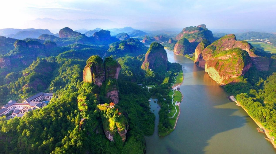
Longhu Mountain Global Geopark is located in Yingtan City, Jiangxi Province, 18 kilometers away from the city center. It consists of six major scenic spots: Xianshui Rock, Longhu Mountain, Shangqing Palace, Hongwu Lake, Mazu Rock, and Yingtian Mountain. It has 55 attractions and 261 scenic spots, covering an area of 200 square kilometers. In addition, it also includes independent scenic spots such as Yiyang Guifeng, covering an area of 40 square kilometers. Longhu Mountain is the eighth world natural heritage site in China, a world geological park, a national natural and cultural dual heritage site, a national 5A scenic spot, a national forest park, and a national key cultural relic protection unit. The entire scenic area covers an area of 220 square kilometers, and Longhu Mountain is a typical Danxia landform landscape in China. Longhu Mountain is the birthplace of Chinese Taoism, and its Taoist holy land, Bishui Dan Mountain, and ancient cliff tombs are known as the "Three Wonders". Longhu Mountain has a forest coverage area of 62%, abundant rainfall, and a warm climate. The negative ion content in the air of Longhu Mountain scenic area exceeds the normal value by 15 times, making it one of the top natural oxygen bars among domestic scenic spots in China.
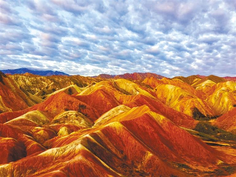
Zhangye Global Geopark is located in Zhangye City, Gansu Province, with Sunan Yugur Autonomous County as the center and a total area of 1289.71 square kilometers. Zhangye World Geopark is located at the boundary of the first step of the transition from the Qinghai Tibet Plateau to the the Inner Mongolian Plateau, in the middle of the northern slope of the main Qilian Mountains, and in the transition zone from the Qilian Mountains to the Hexi Corridor.
The nine spring serpentinite suite in the west is an important material composition of the oceanic crust nearly 500 million years ago, which truly records the evolution of the ancient Qilian Ocean into the Qilian Mountains; The colorful hills are like colorful silk floating on the Hexi Corridor, with their varied colors, unique shapes, and grand scale, making them one of the wonders of world geology; Zhangye Geological Park is the place where the window shaped palace style Danxia is named; The Heihe River, the second largest inland river in China, runs through the park, nourishing the diverse flora and fauna of the park and the multi-ethnic residents represented by the Yugur ethnic group; The rich new tectonic relics in front of the Qilian Mountains record the uplift process of the Qinghai Tibet Plateau over 36 million years. The precious and beautiful geological relics, fragile and diverse ecological landscapes, and long-standing and unique ethnic customs permeate and blend with each other, creating a rich and colorful resource endowment for Zhangye Geopark, and composing a brilliant chapter of Zhangye on the new Silk Road in the new era. Zhangye Geopark warmly welcomes guests from all over the world and from all directions.
Website link:Linyi Yimeng Mountain Global Geopark Management Bureau (linyi.gov.cn)
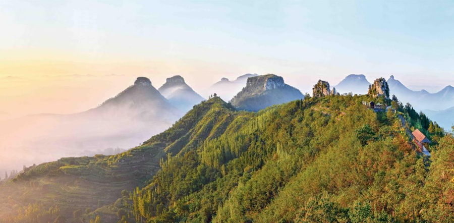
Yimeng Mountain Geopark is located in Linyi City, Shandong Province. It consists of Mengshan Park, Diamond Park, Daigu Park, Menglianggu Park, and Yunmeng Lake Park, with a total area of 1804.76 square kilometers.
The geological park is located on the western Shandong block west of the Yishu fault zone. The oldest strata and large-scale intrusive rock series from the Archean period truly record the history of early crustal formation and evolution in northern China. The "money stone" formed by hydrothermal alteration has unique characteristics. Here is the earliest Kimberlite type primary diamond mine in China, which has produced 1.8 million carats of diamonds. This is the place where the Daigu landform is named, with clusters of typical shapes and spectacular views. Here, peaks rise into the sky, clouds, mountains, misty seas, streams, and waterfalls, creating a captivating natural landscape. This is still the birthplace of Chinese civilization and the center of Dongyi culture, integrating Taoism, Buddhism, and Confucianism. The natural landscape and historical culture converge here, condensing the Yimeng spirit with contemporary significance.。
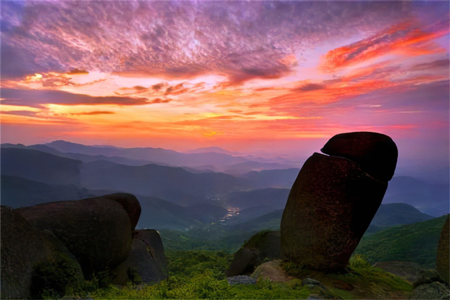
The Wuhuang Mountain National Geopark in Pubei County, Guangxi is a 4A level national scenic spot. It is located at 109 ° 19 ′ 17 ″ -109 ° 24 ′ 45 ″ E longitude and 22 ° 07 ′ 30 ″ -22 ° 12 ′ 10 ″ N latitude, with an altitude of 200-700 meters and an area of 32 square kilometers. It includes one park and five scenic spots: Toutouling, Jintongxi, Yunuxi, Meizhuizhai, and Shizhuling.
The main geological relics in the park are granite landforms, as well as geological relics such as flowing water landforms, small and medium-sized structural landforms, and water landscapes. The park features the most distinctive granite egg landscape. The granite eggs of Wuhuang Mountain are widely distributed and numerous, with a round and graceful appearance and rich imagery. The pictographic stones have a high degree of concreteness and high aesthetic value. The park is also a nationally renowned red vertebrae forest protection area, with a contiguous area of 120000 acres, making it the largest red vertebrae forest protection area in the country. The geological relics of Wuhuang Mountain in Pubei are the product of a specific geographical and geological environment, with significant climate zone characteristics and profound geological background imprints. They have distinct personalities and are rare typical granite egg landforms in China. They have high scientific value for studying the development laws of granite geology and landforms in the low latitude subtropical monsoon climate zone of China.
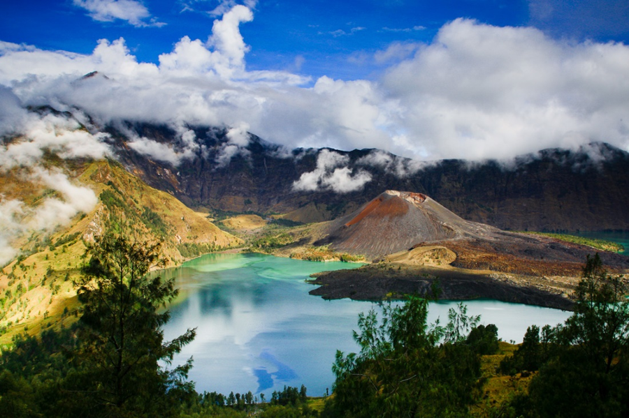
Lombok Island is located between Bali and Sumbawa, and is one of the Sunda Kecil Islands. It is approximately circular and has a 70 kilometer long "tail" - the peninsula. The geology of the island is dominated by Quaternary calcium alkaline volcanoes, covered by Neogene detrital sedimentary rocks, Miocene volcanic rocks, and Paleogene intrusive igneous rocks. The volcanic complex was formed by the subduction of the Indian Ocean plate towards the edge of the Southeast Asian plate. The Sasak population of Lombok Island is multi-ethnic and multicultural, and the diversity of its cultural heritage is reflected in buildings such as temples and old mosques.
Scan to open the current page on the phone