Recently, Professor Chai Bo’s team from China University of Geosciences (Wuhan) embarked on an in-depth geological heritage survey at Jiuhuashan Global Geopark.
Along the route from Tiantai to Huatai, Professor Chai, leveraging his profound expertise in geology and combining it with the geological history of Jiuhuashan, provided students with detailed explanations of the formation processes and geological significance of each heritage site. From ancient rock structures to unique landforms, every site seemed like a vivid geology textbook. Through Professor Chai’s on-site guidance, students not only deepened their understanding of geological theories but also gained a profound appreciation for the marvels sculpted by nature over hundreds of millions of years.
The focus of this survey was a detailed assessment of the stability of the granite shaped stones in Jiuhuashan. Team members employed various professional techniques to conduct comprehensive testing on the rock masses. They used a rebound hammer to measure the hardness and strength properties of the rocks accurately; employing tools such as spring dynamometers, they analyzed and calculated the friction coefficients of coarse-grained and fine-grained granite surfaces under different environmental conditions; meanwhile, a compass was used for detailed measurements of the rock orientations to understand their spatial distribution and strike. These measures provided foundational data for evaluating the structural stability of the rock masses.
In addition, to obtain more comprehensive and intuitive data, the team also used drones to capture full-scale images of representative shaped stones and performed 3D modeling based on the images. This approach allowed a clear visualization of the morphology of the shaped stones and their surrounding environment, providing precise digital models for subsequent stability analyses and further enhancing the scientific accuracy of the assessments.
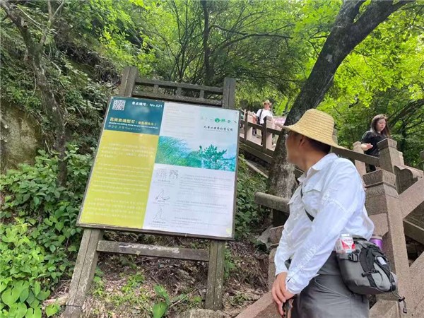
Photo: Professor Chai Bo explaining geological heritage sites to students
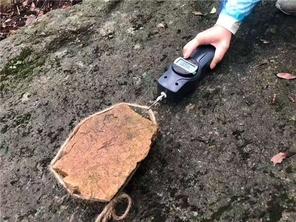
Photo: Measurement of maximum static friction in the friction coefficient experiment
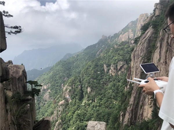
Photo: Students conducting close-range drone photography of typical shaped stones
The geological data obtained through this scientific survey can serve as a core basis for evaluating the effectiveness of geological heritage protection during future reassessments of Jiuhuashan Global Geopark. It provides crucial support for maintaining its scientific research and conservation demonstration value within the global geopark system. Meanwhile, the precise stability assessment results offer quantitative references for optimizing park planning and improving conservation strategies in daily operations, further enhancing Jiuhuashan’s capacity in geological heritage protection and sustainable development.
扫一扫在手机打开当前页